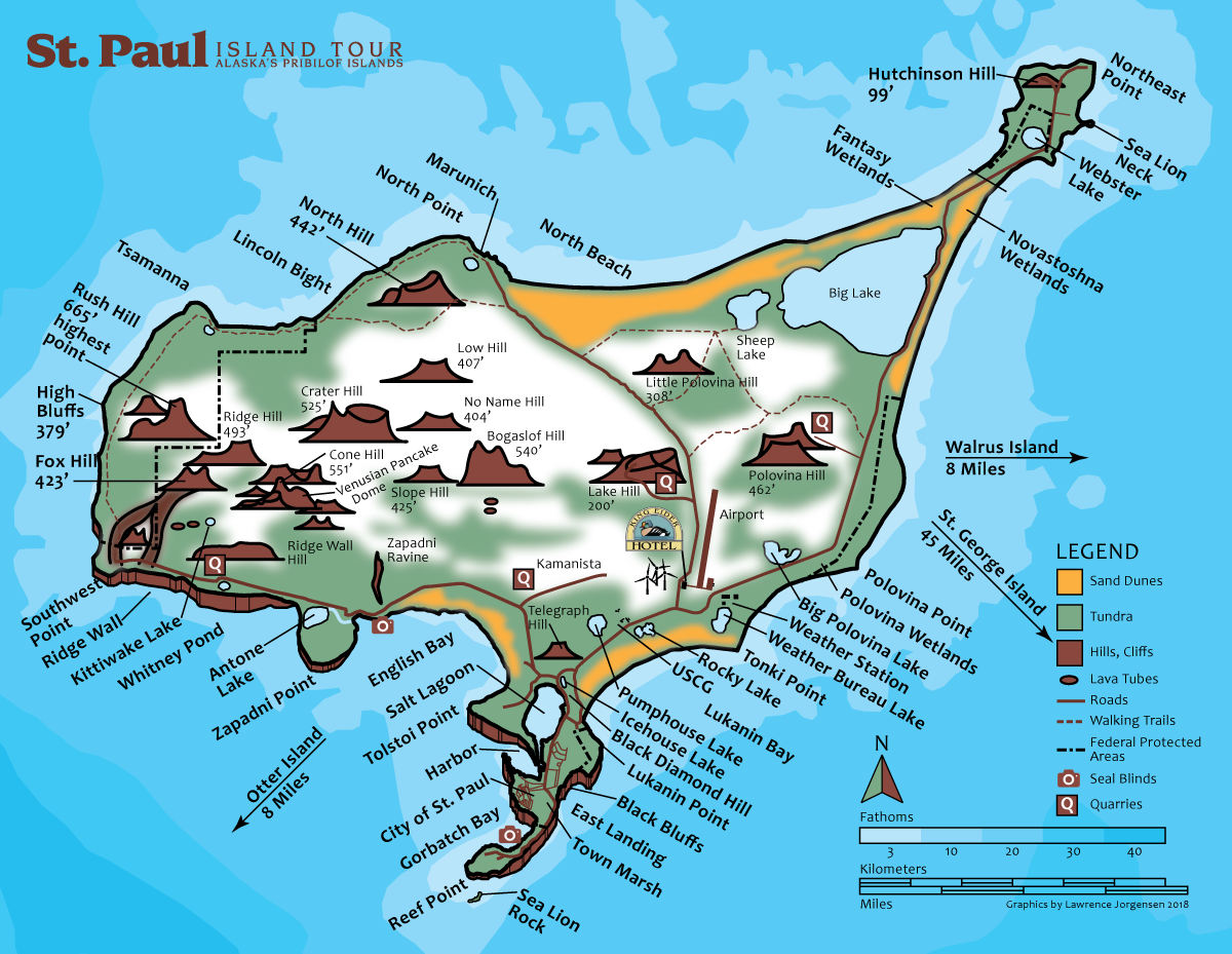
See that dot in the middle of the Bering Sea? That’s us.
St. Paul Island is located approximately 40 miles north of St. George Island, 250 miles north of the Aleutian Islands, 320 miles west of the Alaska mainland, and 770 air miles west of Anchorage. That’s: 57° 07′ N latitude, 170° 16′ W longitude.